Expropriation Archive System
Are there any transactions that you have expropriated in the past years but whose results you are not sure about? With the Expropriation Archive System, you can take control of all incomplete expropriation transactions and reach results without a legal process that may put your institution in a difficult situation.

Expropriation Archive System is a desktop software where you can transfer scanned technical documents and attachments regarding expropriations in your institution to electronic media, and query and view the documents without resorting to the physical archive.
In addition, the Immovable Archive Information System provides a relational platform where you can store the geographical data of the parcels in the expropriation plans, the owners associated with the parcels, the expropriation route and border in the form of a plan in the system.
Before using the Expropriation Archive System, you must transfer your existing analog archive to digital media by using our geographical archive installation services.
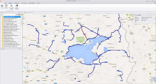
Display of Expropritation Plans
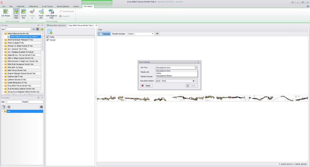
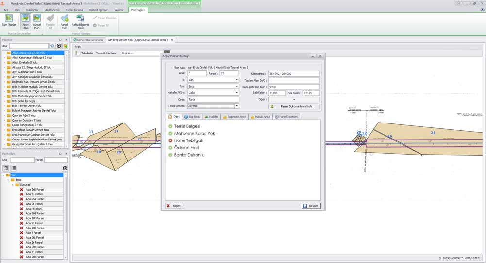
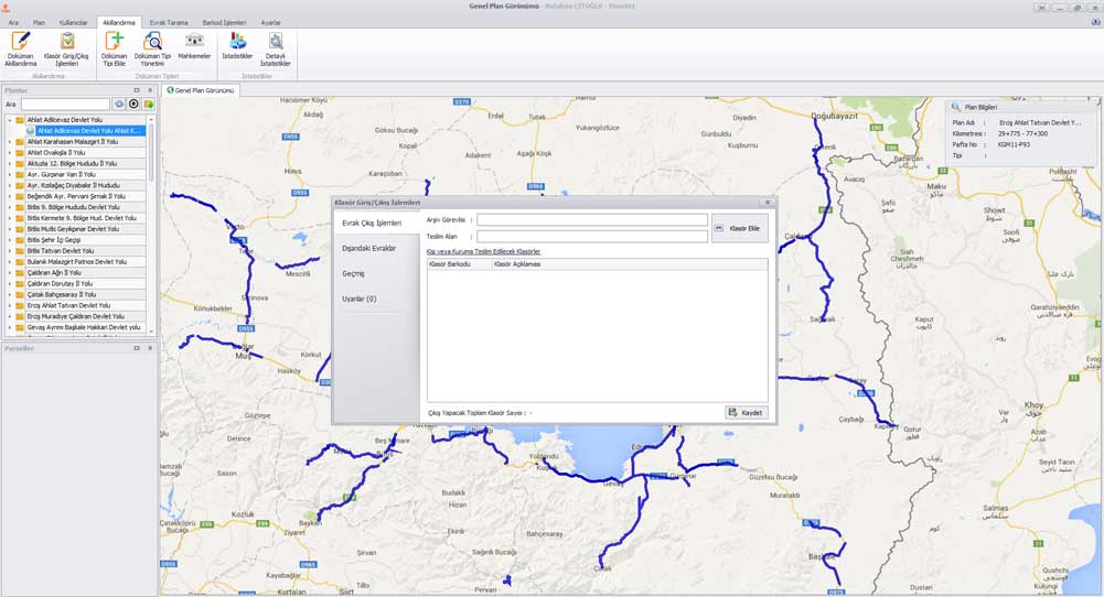
All expropriation plans transferred to the system are shown on a single map with their axes. Relevant plan details can be quickly viewed from the list or on the map. All parcels belonging to the expropriation plan are listed in the same way.
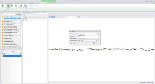
Map and Layers
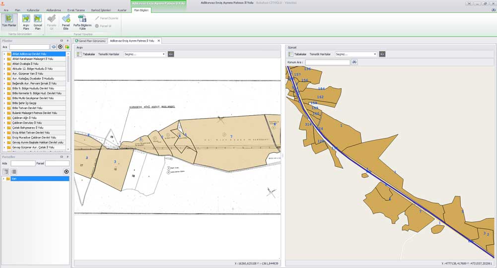
You can view the archive plan and the current plan with two different map screen options. You can transfer the sheets of the expropriation plan to the system as a base. It also provides the opportunity to transfer the parcels of the plan, expropriation axis and borders to the system by matching them according to the desired coordinate system. Numeric data supports many file structures such as *.shp, *.tab and *.dxf.
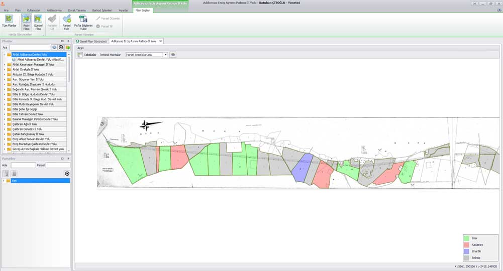
Thematic Display
It provides thematic report information based on the registration, matching and rationalized document information of the parcels belonging to the plan.

Before and After Expropriation with TAKBIS

Intelligence System
Transfer your scanned files to the system in bulk in one go. It offers you an advanced user interface for quick analysis of documents transferred to the system. Documents translated in the appropriate format are associated with the parcel and owner by the user and stored on the server. During the rationalization process, documents are classified according to their types and the desired fields are transferred to the digital environment.
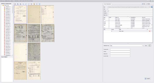
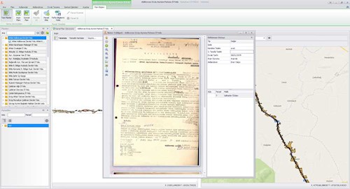
Examine the Archive Document Related to the Plan and Plot
All archive documents belonging to the relevant plan or parcel are shown grouped according to document types. You can review the document you have selected via the advanced document viewing window. Document types and other intelligent fields pertaining to the document type are displayed on the document viewing window. Additionally, authorized users can download documents to their computers.
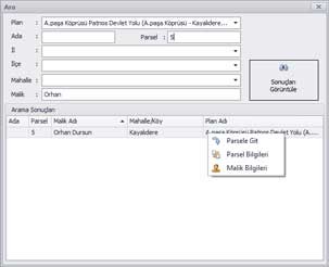
Quick Access with Advanced Search Option
It provides the opportunity to access the numerical data transferred to the system on the map or the related archive document with a single query by querying the province, district, neighborhood, island, parcel, plan and person within the system.
Take a Closer Look


Archive Setup
In order to switch to a digital archive management, your existing archive needs to be scanned, digitized and smartened.
Get more detailed information about our archive installation services that we provide with special methodologies for geographical archives.