AgroWorks
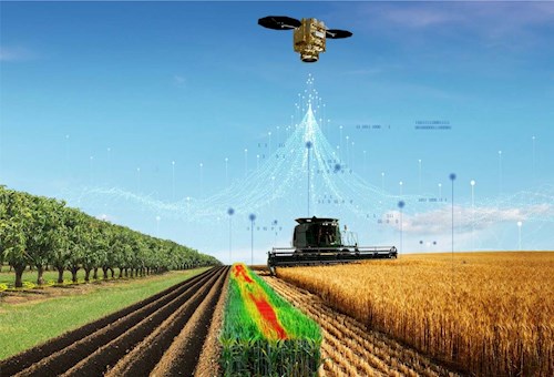
Processes such as plant species analysis, yield estimation, irrigation analysis and agricultural parcel identification have been carried out for years using satellite images or images taken by unmanned aerial vehicles.
We aim to carry out your agricultural activities much more effectively by completing these processes quickly and at low costs with the artificial intelligence-based analysis methods we have developed under the name "AgroWorks".
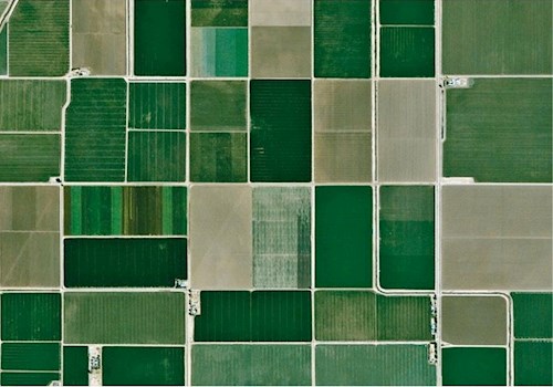
Current Satellite Images
AgroWorks provides the most up-to-date satellite images, keeping you informed of the latest status of your irrigation area. These images taken with radar and similar sensors also allow you to perform numerical analysis.
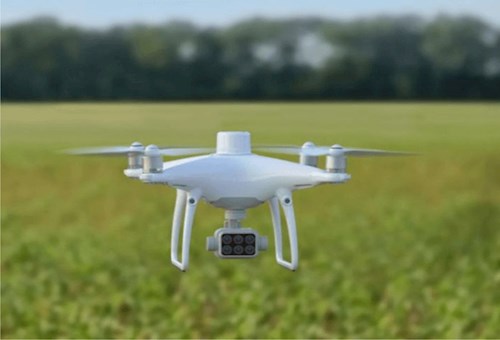
Unmanned Aerial Vehicles
Our customers who do not prefer satellite images will not miss any detail of the irrigation area with the high-resolution aerial photographs taken by the unmanned aerial vehicles operated by AgroWorks.
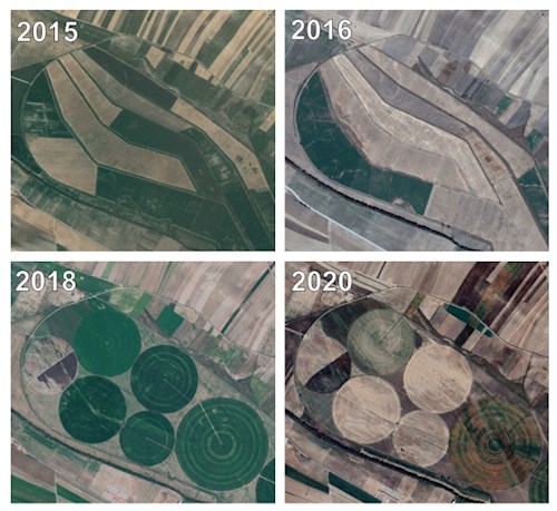
Images From The Past
AgroWorks can provide images from 5 years ago with its unique archive of satellite images taken at 5-day intervals. In this way, you can quickly reach a solution on issues you have a legal dispute by analyzing past agricultural activities.
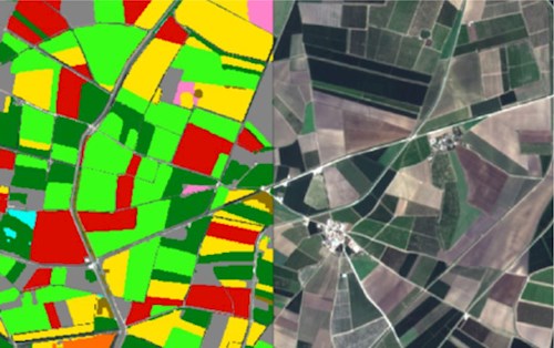
No More Illegal Irrigation
AgroWorks determines the boundaries of agricultural parcels with high accuracy using up-to-date satellite images and aerial photographs. In this way, you can easily detect illegal irrigation.
Fast And Reliable Measuring
Thanks to the artificial intelligence algorithms it operates by taking into account historical satellite images and crop phenology of your region, it allows you to make surveys with an accuracy of over 90%. You only go out to the field for control.
Accurate Irrigated Area Calculation
Thanks to the current parcel boundary and accurate survey, you can calculate your irrigated area rate precisely and prove your success.
Automatic Accrual Calculation
AgroWorks provides information about the detected plant type, crop period, irrigation method, etc. It automatically determines water usage, taking into account other factors, and quickly calculates your accruals.

Frequently Asked Questions
1. Is AgroWorks a software ?
AgroWorks is the general name of our consultancy service that will enable you to carry out your irrigation management more effectively using artificial intelligence technologies.
2. What software will I use the services offered with ?
We provide the necessary software to query and display the data resulting from all the services we offer, free of charge, and make it available to you. For some software, a one-time installation fee may be requested.
3. How do I view the services offered in my own program ?
We clearly present the data we produce within the scope of our AgroWorks services in Excel and similar formats for importing or viewing, if your software allows.
4. How can I use satellite images or aerial photographs produced during the service ?
The aerial photographs we produce during our work are licensed to your organization. Therefore, they can be used unlimitedly by your organization for your organizational activities. For the use of satellite images, the usage principles of the satellite company providing the image apply.
Service Brochure
Click to get detailed information and download the promotional document.